Anhalt
Location |
SW tip of Vågsøy |
Position |
61º 56.732´N 05° 08.260´E |
Depth |
50m+ |
Chart |
P800 |
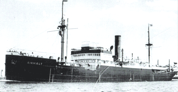
The Anhalt was a 120 metre 5870brt German freighter built in 1921 and used for troop transports. She was damaged by Allied aircraft in December 1941 during Operation Archery, a major air and sea attack on Måløy in which 8 enemy ships were put out of action. She went aground on fire at Båsundhalsen, and remained there until she was eventually sunk by a further air attack in May 1942.
The position given corresponds to a charted wreck just N of Måløy, which we have steamed over. It appeared to be just beyond air diving range. However, other reports give the Anhalt as being in shallow water at Vågsøy 61° 29.3' N, 05° 01.2' E, which is 30 miles away, to the S of Flørø. There are three charted wrecks close to Måløy, and several vessels believed to have been lost in the area. See Klaus Fritzen et al for further details.